Bougouriba Province (Province de la Bougouriba)
Bougouriba is divided into 5 departments:
See also:
* Regions of Burkina Faso
* Provinces of Burkina Faso
* Communes of Burkina Faso
Map - Bougouriba Province (Province de la Bougouriba)
Map


Country - Burkina_Faso
 |
 |
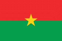
| Flag of Burkina Faso | |
The largest ethnic group in Burkina Faso is the Mossi people, who settled the area in the 11th and 13th centuries. They established powerful kingdoms such as the Ouagadougou, Tenkodogo, and Yatenga. In 1896, it was colonized by the French as part of French West Africa; in 1958, Upper Volta became a self-governing colony within the French Community. In 1960, it gained full independence with Maurice Yaméogo as president. Throughout the decades post independence, the country was subject to instability, droughts, famines and corruption. Various coups have also taken place in the country, in 1966, 1980, 1982, 1983, 1987, and twice in 2022, in January and in September, as well as an attempt in 1989 and another in 2015.
Currency / Language
| ISO | Currency | Symbol | Significant figures |
|---|---|---|---|
| XOF | West African CFA franc | Fr | 0 |
| ISO | Language |
|---|---|
| FR | French language |